Monday, April 30, 2018

Day 11, 20.20 miles!!

Woo-hoo he’s on a roll!! Another 20+’er in the books! I planned to wake up early today, but it was a chilly morning and I hit the snooze, haha. Nonetheless, I was out of camp by 6:45am. Like I said, the morning was quite chilly, so I started off hiking in my leggings and mid layer top.


The mornings always blow me away 

 I told the other three gentlemen not to worry if they got up earlier than me, and that I’d catch up. I discovered that I had the new alternate maps and GPS locations on my phone, and the weather forecast actually changed in Idyllwild so it’s looking like getting there tomorow morning will be perfect.


Waaaaay better!

I heard the others leave about 30 mins ahead, so I hustled up the hill. About 2.5 miles in, I decided to stop and hit an off-trail water source. I knew that the next section had a lot of uphill, and even though it was a cold day, hydration is important! I read of my water report 0.3 miles W of PCT. “Oh great, shouldn’t be bad!” I thought. WRONG! The small spur trail was STRAIGHT down the elevation I felt that I had just slowly climbed in the last two miles!

Down I went, leaving my pack and rainfly and tent out at the top to dry and carrying just my empty liter bottles of water down the steep and rocky path. Besides the needed water, the extra .6 miles weren’t totally wasted!


A beautiful new red Yucca!


It looks green in color but it’s actually quite clear! (There is sand and silt and algae settled on the bottom)


I thought this was a trail register at first glance but I guess they’re researching foxes and raccoons at the watering hole.. RACCOONS?! I better get back to my pack/food bag! 

Luckily everything was still there in tact when I got up the hill. And just a few moments I saw Amy and Jamie! I was glad to see them, but Jamie had heartbreaking news, he said: “Taco day at Idyllwild is Monday and Thursday not Tuesday!!!!”

Ah, the pain, the horror, the agony! I had been talking my loud mouth off for the last 3 days to everyone I met: “$1 tacos on taco-Tuesday in Idyllwild, come join me if you’re in town on Tuesday for my birthday!!”
I’d been “planning” this for days! I soon recalled that in fact yes, in 2016, Claire and I hit both $1 taco nights on Monday and Thursday..

But you know what? Things like that made that year special, and other things will make this year special! Like road-walking on my birthday into Idyllwild and then getting Mexican food anyway! Besides, it’s not the $1 aspect of $1 Taco Night I’m so excited about, it’s just the Taco aspect :)

Anyways, enough about food! I split ahead of th and climbed climbed climbed! I climbed forever today!


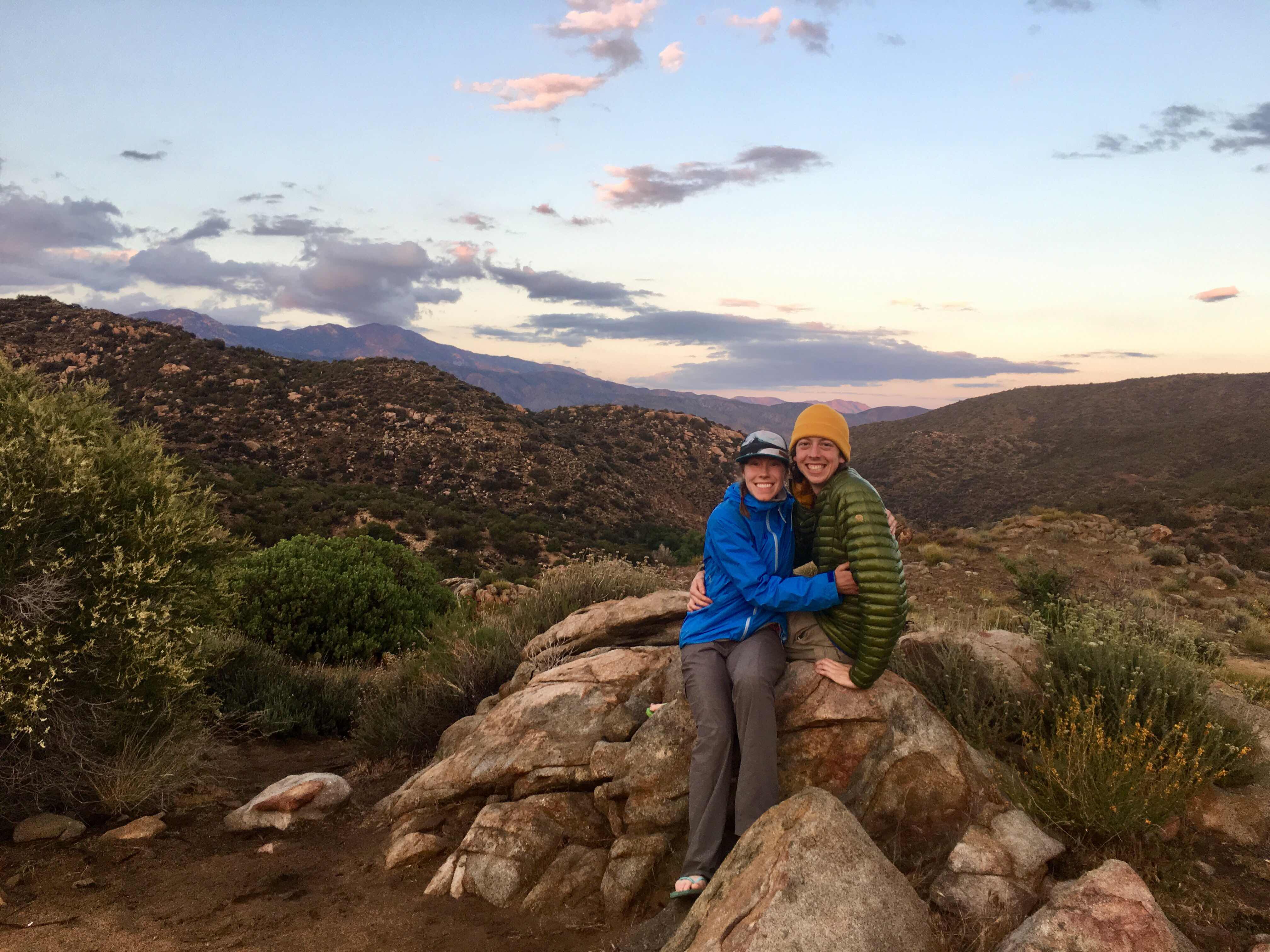
Photo by Jamie, of Amy and Jamie


As I got higher and higher, some clouds starting pouring over the hillside behind me!

Soon I passed the Cedar Spring Junction, the point that Claire and I had to drop down in 2016. We never did get to see the new burn area since it was still being worked on and the trail was closed. Today I got to see about 8 new miles of the PCT!


Where the burn begins


There’s really something beautiful about burns that are a few years old. The tall, massive black and charred trees contrasting against the impermeable organisms like boulders and rocks and dirt, and the new rapid vegetation and grass filling everything in.

With that of course comes Poodle Dog Bush!!

I wasn’t expecting to see this stuff so early on, but it makes sense with the “recent” fire. The plant starts growing ~2 years after fires. The leaves are more potent and dangerous than poison oak. For the most part, all of the PDB I saw today was burnt and cut, but a few prominent stalks like the one above didn’t quite die and are still growing!

On my climb I ran into Ben again. He had camped just near us after I went to bed but must’ve woken up pretty early. He puts it like this: “I’m slower but I go for longer. Good strategy! Ben was running dangerously low on food, and I had a few 100 calories to spare, so I gave him a clif bar and some of the trail mix and pretzels I had scored at Warner Springs.

I also ran into Pilgrim again. Pilgrim is wearing a full and legit robe on the PCT. since today was so cold and windy at times, the photo I captured has his high-tech puffy covering the robe:


Pilgrim

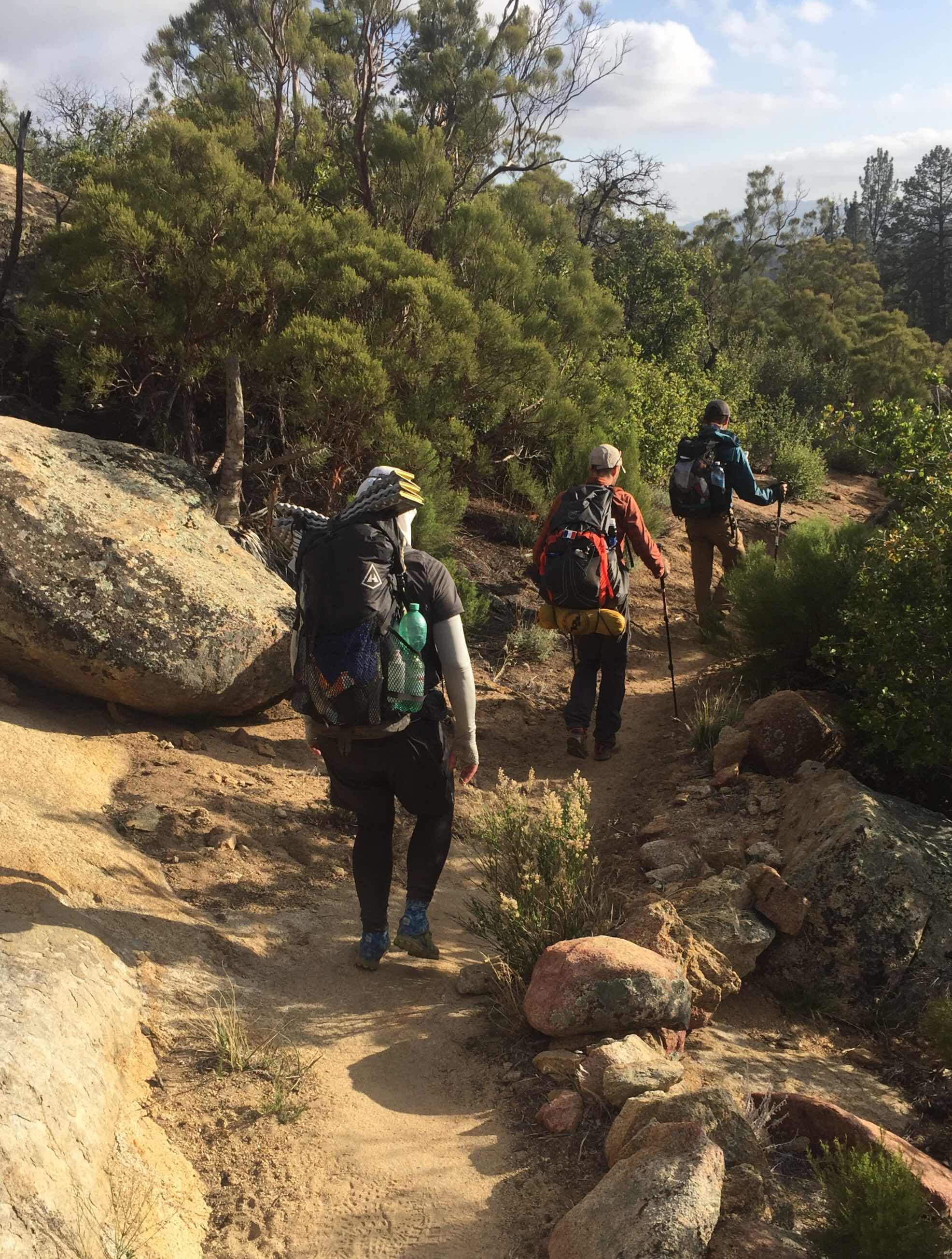
Of all the people I met today on trail, I believe myself and the three others ahead of me that I’m getting the room with tomorrow in Idyllwild, are the only hikers walking as much of the PCT as we can legally, and then walking into Idyllwild on alternate trails/roads. Amy and Jaime along with Ben are taking Fobes Trail down, the trail in between Cedar Springs and Spitler. Pilgrim IS hiking down at Spitler, but then hitching into Idyllwild. 

I don’t have anything against anyone who is doing anything other than me, especially given the bad weather ahead. I’m just thankful that the timing happened to work out this time and that I get to continue my continuous footpath to Canada!


I passed the sign in the first picture after the others dropped down Fobes trail. In the second picture above, Spitler Peak is hidden in ominous clouds.

Pilgrim and I began our SUPER steep ascent up to Spitler Peak. This is hands down the steepest part of the trail that I’ve ever been on maybe with the exception being Mt. Baden Powell in a few hundred miles. This was SOOOOO steep! The fire must’ve destroyed the old switchbacks because, by golly, we went straight up the mountain... 

It was 2.7 miles of all uphill, and as we neared the top, other clouds started rolling in, as if almost trying to cut us off from the peak. It was cold but absolutely beautiful..


Looking left (west), into the gray abyss of the Jacinto hillsides. Looking right (east), is a sunny Palm Springs way down below!!

It definitely reminded me of the island of Oahu back home in Hawaii. It’s a small island divided right down the middle by a mountain range. I’ve been up in the middle of the island when half the island is invisible and half the island is a beautiful sunny day with not a cloud in the sky...


This is MacGyver. I met her on the steep steep climb just past Fobes cutoff. She is such an inspiration! She saved up for four years for her PCT trip, BROKE her back, lost mostly all of saving towards medical bills, and is out here on trail the very next year. CRUSHING it I might add! She is also doing the Spitler alternate. I actually saw her walking up the steep dirt barefooted! She has 0 blisters on her feet as she hiked about 1/2 the day barefooted (when terrain allows), and her feet stay dry and airy. I only thought to take a picture after she had put on her shoes for the rocky descent.


After finally arriving at Spitler Junction, it was time to go STRAIGHT back down! The real was very steep but beautiful. I caught up to Pilgrim who was right in front of me, and I asked him to take a picture of me, and he captured a great sequence!


Down down down down and down for nearly 5 miles. Finally, Pilgrim and I got to a road, and started walking (yup, you guessed it), DOWN it..


Looking up from where we just came from..

The road was an uneventful 2 miles. I FINALLY got service and called my baby for about 20 minutes. The wind was picking up and the temps dropped way down. I put on my rain jacket, beanie and gloves.. I was planinng on stopping at the trail head, but there wasn’t much for camping there and everything was very exposed. I figured I’d just walk a little more and find a nice stealth camp spot along the alternate further down. It’s forecasted to rain.

I ended up walking 3 more miles of the alternate, and finding a nice spot tucked next to 3 big, live pines. The needles make for soft ground and the trees are protecting me from the wind outside. Second night with the rainfly!


Stealth mode :)

Well, that’s it for today! I climbed about 4,100ft and dropped 4,800ft today! The feet still have 0 blisters, the knees and quads, not so happy, hahaha. Tomorow I climb a bit for 6 miles walking on a series of bike paths and dirt roads and the a residential road to get into Idyllwild by foot. Then it’s food time and warm cabin with a fireplace time!! (And laundry time)!! (And shower time)!!

Thanks for reading!!

Day 10, 21.08 miles!!


Oh what a beautiful moooooooorning! Oh what a beautiful daaaaaaaaaaay, I’ve got a wonderful feeeeeliiiing, EVERYTHING’s going my waaaaay!

Sorry, just had to get that out of my system.. as you can see by the picture above, it was a beautiful morning, and as you will see from the rest of this post, it was a beautiful day :)

Again I “slept in”, but left camp right at 7:15am. I had made it down from up high last night, and could here the winds roaring from my safe cozy place down in the valley. Within the first two miles l recognized a familiar rcampsite and rock:


This was the ace where Claire and I had camped after getting hailed and rained on on my birthday last year. It was definitely a roller coaster of a day, but ended with a beautiful pastel sunset and a genuinely happy moment :)

Ok, just a warning, this post is super photo heavy, (probably because I walked over 20 miles and this part of the trail is absolutely gorgeous!)

It was also very hard and was essential up and down giant ridges all day. Today I climbed almost 3,700ft and descended over 2,500. Hard on the quads and knees to say the least! 


Cliff-side trail carving. A fall from the middle of that incline over those cliffs would not be fun.

I used my trekking poles like a pro today, shortening for the uphills and lengthening for the downhills. The trail was tough but beautiful. Every time you came around a big bend you could see your next few miles of trail, going down to the next valley and coming back up!


Look at all those layers in the far back middle!

The day way a bit cooler than it’s been, although also very windy. I reapplied sunscreen not as often as I should because of the cool temps and breeze, and I got a nice face burn from both the sun and the wind! There were 2 10 mile waterless stretches for me today. I carried 4 liters from Mike Herrera’s place yesterday so I could avoid two sketchy water sources and not rely on the water caches. However, this as is a pleasant sight to see in the middle of a long dry day:


A sweet water cache off a Jeep road

It was here I officially met Shadow, Treetrunk, Splash, Kat, and Chip. Shadow is from France hiking by himself but happened to be at the cache at the same time. The last four I had briefly seen in Warmer Springs. They are hiking as a group though I’m not sure if they knew each other before-trail. 


Saw my 3rd snake today, still no rattles!!


Can’t 


Stop,


So, 


BEAUTIFUL!!

I was FLYING through the desert! Feet felt great, body felt (mostly) great. Since it was a cold morning, my left hamstring started aching and wouldn’t let up as it never fully warmed up outside. Nothing major, just annoying. Luckily, at that water cache, Kat had some (heating cream?). Kinda like a hot/cold ointment that really really helped! I traded her a squeeze of that for a Werther’s Original I had found in a hiker box.

Okay guys, check this: I hiked 17 miles by 3:00pm today! That’s over 2mph for nearly 8hrs INCLUDING breaks! Why you ask? For this of course:


I already forgot what this burgers name was because I don’t remember much for about 2 hrs after I ate it because of my food coma, hahaha! How come the veggies are hidden under the fries? Well because there’s 2 half-pound patties (yes that’s right folks, a whole pound of beef), two slices of cheese, bacon, AND guacamole taking the spotlight!

I ordered this monster at the Paradise Valley Cafe, 1 mike west of where the PCT intersects with highway 74. After walking 17 miles, of course I hitched to one mile, haha. I got a pretty quick ride from a nice lady headed that way. When I arrived I saw Julian (the one who I moved the firewood with yesterday), Shadow (the Frenchman I met about 10 miles back, and Joseph, and older German man who hikes VERY fast and doesn’t have trekking poles.

I joined their table and since they were in a food coma as well, we were all ready to leave at about the same time. As we were leaving, some others arrived. We saw Ben (who I met at Mike’s yesterday and camped near last night), and the other four I had just met at the cache along with Shadow. 

It was time to hitch back to the trail to get a few more miles in, so I pulled out my fancy hitchhiking sign:


We had no luck for about 10 mins, maybe my legs were too dirty?! :p

In the end, it was Shadows smooth talking in his French-accent that landed us a ride. He had talked to a couple in a pickup that were leaving the restaurant. And even though they were headed the opposite direction, they said they’d take us a mile down the road.


My second pickup rode in two days!
Left to right: Two-pack, Julian, Shadow, and Joseph

At the cafe we all had talked about the upcoming section. It’s still 27.5 miles up a huge mountain ridge to Idyllwild (our next town stop) if you were to hike the PCT all the way there. Only problem is that a section of the PCT is still closed for fire recovery and re-building if the trail from a fire back in 2013. In 2016 when Claire and I hiked the trail, we had to climb up the PCT and descend down the Cedar Spring Trail, and then follow a really crappy dirt road down to highway 74, and then follow it to another dirt road, and THEN walk waaaay uphill into Idyllwild. The alternate we took added like 10 miles to the usual trial miles in the PCT.

Since then, they have managed to open up about 8 more miles of trail and so now you can take the PCT all the way up to a trail called Spitler Trail. From there hikers can drop down west, similar to the Cedar Spring Trail, but instead of having to hike on dirt roads and the highway for about 10 extra miles, there are a series of small gravel roads and other trails that lead back up to Idyllwild much quicker. The whole alternate just adds 3 miles to what we would walk on the PCT. 

All four of us would like to walk a continuous footpath and not hitch, plus, when hikers hitch from Highway 74 into Idyllwild, they miss 17+ miles of magnificent trail miles that are open up to Spitler Trail! Here are some pics of just the first four miles, to where we decided to camp tonight.


Sorry poor lighting, but it’s like walking into boulder-El Dorado..


Julian, Shadow, and Joseph

We are all a VERY similar pace, at least from what I saw today. Joseph has the lightest pack and flys downhill, where I’m more careful downhill but make up speed on the inclines. Julian is the youngest (24) and takes the least breaks, he’s probably the quickest of the bunch. From what I can tell Shadow and I are about even.

That’s not really important though. What ISO’s that we’ve decided to hike into Idyllwild as a group more or less. There are a few reasons for this. One, this is unfamiliar trail for all of us and sometimes directons with a new alternate can be iffy. The four of us together will easily stay on track. Two, if you recall my previous post about the upcoming weather in Idyllwild, you’ll understand our haste and wanting to stick toegether. Tomorow night might get very cold with a chance of snow Tuesday, when were expected to be approaching Idyllwild. Three, BECAUSE of the horrible weather Tuesday night, Julian booked a room at the Idyllwild in, and it will only cost us about $25 each. I wasn’t planning on staying in a room this early on, but with Tuesday night looking like this:


I’ll pay $25 to not freeze and have a hot shower/laundry :)

We went about 4 miles north from highway 74, bringing my total to over 21! Woo-hoo! I normally wouldn’t want my pace/length of day dictated by anything, but over lunch/dinner, we all looked maps/weather and realized it will be in our best interest to make it up to the point where the Spitler trail drops off the PCT, and make it down a couple thousand feet in elevation before nightfall. The Split off to Spitler is over 7,000ft elevation, and you don’t want to be up there on a below-freezing night with the possibility of snow or strong winds. That’s why we hiked so far today. But you know, I’m feeling great! No problems in the toes, I’ll have to see how my hamstring feels tomorow and Tuesday in the cold. 

In other news, this is the first night I’ve actually set up my rainfly on my tent! I don’t expect it to rain, just to be very cold. Look pretty good huh? 


Tent and rainfly and poles and stakes: 1lb, 15oz :)

Well, that’s it! Sorry for the super long post! I hope I’ll have service tomorrow afternoon once we drop down from the ridge. This is my projected end point tomorow:


Hoping for 17.4 miles tomorow, with 3,995 ft gain and 4,241 ft loss! Dang!! 

Thanks for reading!! 


Sunday, April 29, 2018

Day 9, 18.72 miles


Whew what a day!!i woke up on my sweet, private sandy beach to a much colder-than-expected morning! My sleeping bag was a little wet on top, perhaps from being so close to the stream? Nonetheless, I stuffed it in my bag to deal with it later, ate some more frosted mini wheats, and hit the road by 6:45. My fingers stay way colder than the rest of my body in the morning and evenings, so I made sure to throw on my Possimdown gloves. 


Matching!

The morning was sooooooo beautiful! I really enjoy getting a nice and early brisk start ahead of the sun. Soon it came in shining through, making for quite a picturesque beginning to my long day:


Up up and up I climbed, soon leaving the tree’d creek area behind and bursting out into exposed ridges. Today was my first day actually listening to music while hiking. I’ve been missing out! I mainly listened to Credence Clearwater Revival, and two of my favorite artists, Stick Figure and Alborosie. It’s crazy how quickly songs and entire albums go by when you’re walking for hours and not just driving to the grocery store. Pro-tip: Faster pace jam-bands are great for uphill, Reggae is good for flat and downhill :)

I started leap-frogging a group of three hikers and another group of two. I’ve seen them quite a bit and even talked to them but just today learned all 5 of their names. I don’t have a picture of Amy and Jaime but they’re really cool. The other three were coming around a bend as I was taking a panorama of a SWEET break-spot atop a boulder, check it out!


Love this picture! Sharp-shooter, Emily, and Walter in order of appearance. (The trail went right under my epic boulder.)

The boulder fields continued and there were cool formations to be seen left and right.


This one kinda made me nervous:

Splat potential for sure...

In the left of this picture is wild lilac. It’s so pretty and was growing EVERYWHERE today!


Love the blue 


Also, plenty of these guys

After 12 morning miles, just as the sun was starting to get hot, I saw the spur trail for Mike Herrera’s house. 


As I mentioned in a previous post, Mike has a house just off trail (nearest neighbors and 6 and 10 miles away). He works with a company that sells commercial kitchen equipment, so on his property he has three giant water tanks for hiker use as well as a sweet kitchen-type-garage-area where he often makes pancakes in the morning, hot dogs for lunch, and pizza and cake for dinner!! 

Today Mike wasn’t there, but when I rolled up (I was the first hiker to arrive), I saw a familiar face!


This is Josh (but now he has a trailname “Off-trail” He is the caretaker of the property while Mike is away and lives on site. He remembered my face from two years ago! When a few other hikers arrived, including the 5 that were close behind me, he started whipping up some grub. Last year Claire and I stopped by in the morning for some pancakes and lots of carrots. Today it was hot dogs all the way!


After lunch Off-trail asked for volunteers to help him load up some firewood to stoke the brick oven for tonight’s pizza. I volunteered along with a hiker named Julian. I had met Julian IN Julian, and he lives in Los Angeles. We hopped on the tailgate of the property truck, and enjoyed a speedy and bumpy ride to the old manzanita burn site. 


Julian after we loaded up the truck

 I didn’t take any actual pictures of the hiker hangout, as I was too busy eating, relaxing, catching up with everyone, eating, filtering water, and did I say eating?

While I was there I met a cool hiker couple who’s names are Poppy and Tree-man. Tree-man has some sweet dreads and Poppy is from Portland! I also met Ben and Shadow, and got to see Andre again for a brief second before I left. 

Ok here’s something crazy: so in 2016 I was at Mikes the morning of my birthday. Then Claire and I headed out probably around 10 or 11 am to get some more miles in. After the sunny, 80° climb out of the area where his home is, we got hit by a random hailstorm and then a long downpour of cold rain! Below are two pictures: the first was today and the second is the EXACT same spot, May 1st, 2016


Crazy huh?!? (That’s hail Claire’s standing on)

So, body update! My toes are in full recovery mode! All toe blisters have subsided with the introduction of injinji toe socks, and side of foot and ball of foot areas have stopped hurting now that I’m wearing Timps in size 13 with extra padding. I feel great! I do have small blisters under the calluses of each outside heel, but they are covered in leukotape and are bearable.

Having trekking poles from the start of this hike are really saving my knees, and I can feel my body becoming stronger. My pack is light, I have extra water because of it and am staying extra hydrated and sunscreened. I’m feeling GREAT!  I was able to pound out about 6 more miles after Mikes house, putting me at over 18 miles today WITH a 4 hour break! Woo!

I have service at my campsite tonight and have been researching the new alternate to the San Jacinto mountain fire closure form the fire in 13’. I have a sweet plan which I’ll detail tomorow. It’s 9:20, past my bed time!

Thanks for reading!