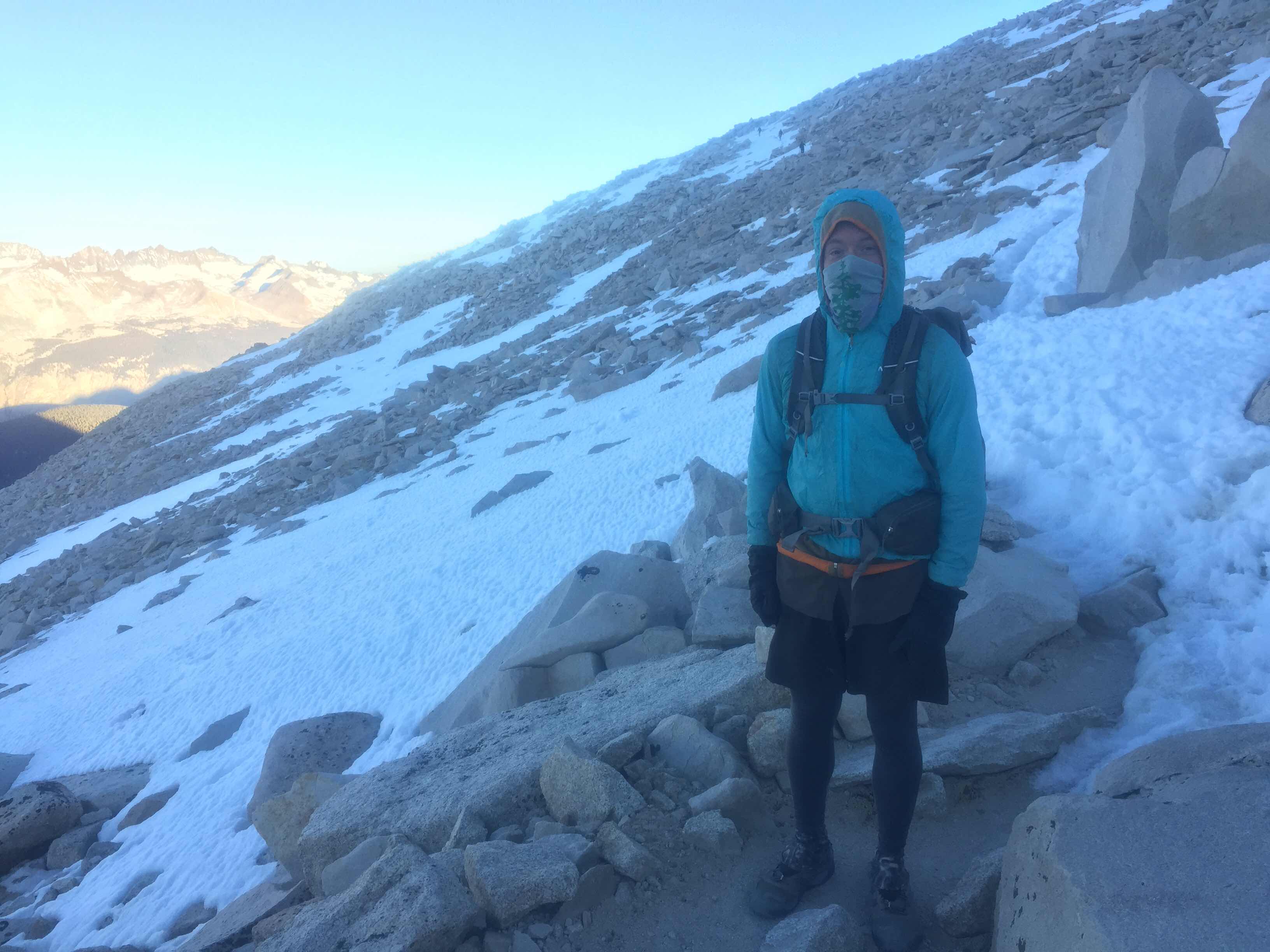
We had slept at Guitar Lake and planned to get up at 4 and start hiking by 5am to summit Whitney. For some reason I could not sleep at all and was wide awake by 1:30am. I decided to get ready for the day as Happy said he was headed out early. I got all layered up, put on my contacts, got out of my tent, and oh my...
We had the clearest sky with tons and tons of stars. The night was not as cold as last, and it felt nice outside since I was all bundled up. The moon was hidden behind the huge mountains, and you could clearly see the Milky Way!! In the distance you could see a long line of headlamps switchbackimg the scent of Whitney, from people that had left Crabtree ranger station at midnight in order to see the sunrise from atop Whitney.
I started cooking some oatmeal and soon heard both Julian and Keglegs get up. They couldn’t sleep well either! I asked if they were down for an early start and we decided to go for it! But first, let’s get back to the oatmeal...

Organic whole oats with cranberries, walnuts, chia seeds, and chocolate coconut peanut butter, thanks Claire!!!
We started walking with our headlamps. We couldn’t see much at first, but I knew that all three of us would be STOKED to see the area after the sun came out.


There was some snow and ice on the initial switchbacks, but nothing we couldn’t handle in the dark. Within about half an hour, the super bright moon which had been previously hiding behind Whitney, finally popped into our field of vision. The Milky Way faded away, but there was just enough light to see out!

At this point, my phone was so cold (as we all were), and had had enough. The camera froze and couldn’t take pictures, and the whole thing started glitching. I turned it off to turn it back on and it went from 80% battery to 1%... Oh no!!! I had left my charging kit back in the tent, and I was sure my phone was done for the day.
The next photo I took with Julian’s phone, and it might be my favorite from the day!

Just wow...
The other two suggested I just put my phone in my puffy jacket to let it warm up, and sure enough, about 1/2 an hour later, it was back up to 75%! For some silly reason most of the pics today have faint red lines running through them, but just try to look past that since they’re the only pictures I have!

Keglegs and Julian crossing a snow traverse

Well before sunrise, yet that band was shining!


Sorry for the lines!!
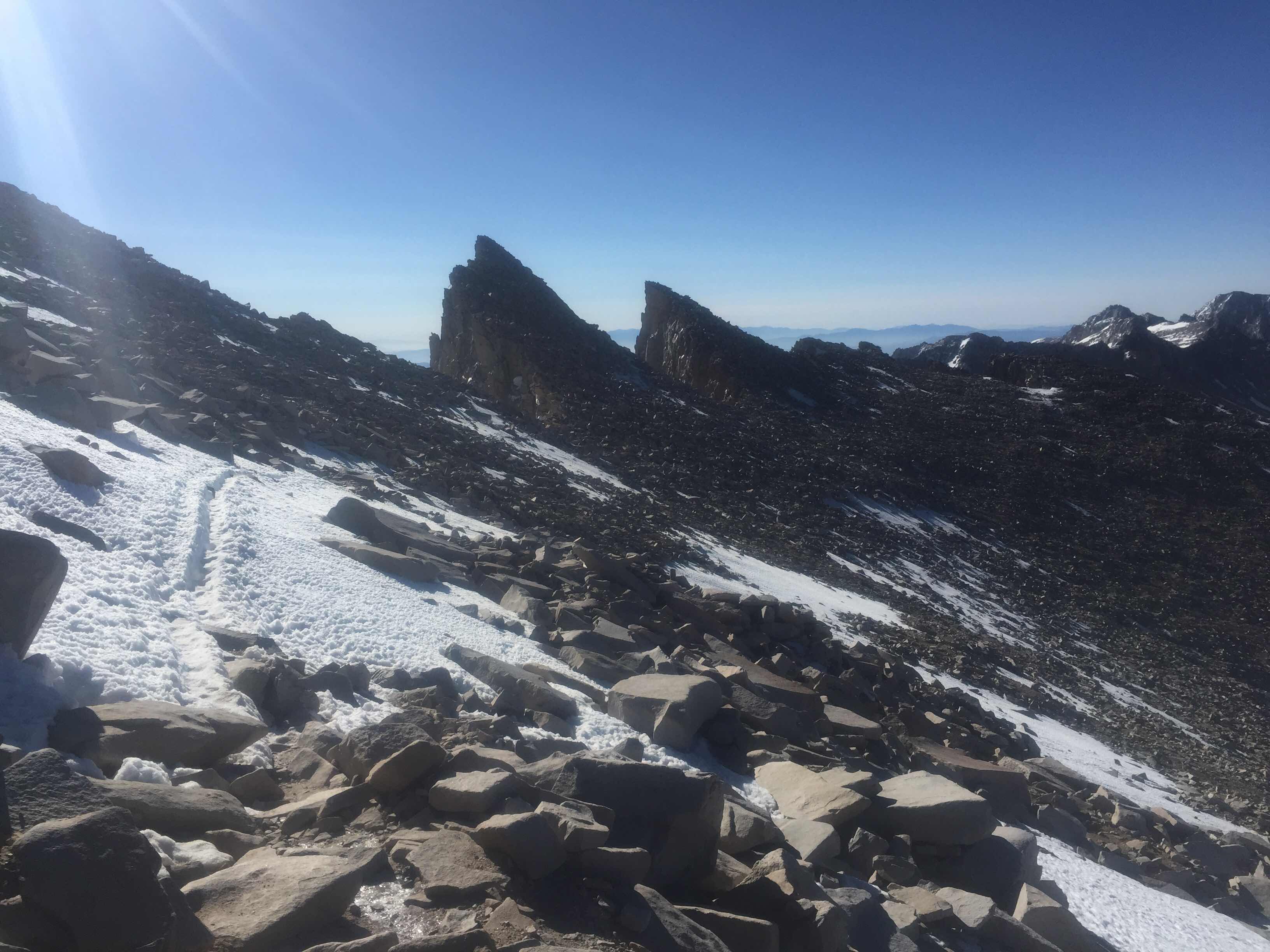
I gotta say, this steep steep climb at such a high elevation was really kicking our butts! Our packs were super super light since we left everything at camp. But when it’s super hard to just breathe, it’s even harder to hike up to the tallest mountain in the US! Soon we were within the last couple miles, just a little further than Claire and I got in 2016 since we dropped down after the saddle to the Whitney Portal since we were still fresh with the Noro.


The summit coming into view!
We ran into Happy all bundled coming down from his sunrise summit. Still Happy!!!

Mt. Whitney emergency shelter


Summit on the edge

The summit crew!!

Looking down the east side


:)

Inverted on top of the world
We spent a little time up there in the sunny cold. There was full LTE service so I called all my family (except sister Sarah because it would’ve been waaaay too early!) After awhile we decided we should head on down since we wanted to squeeze in a Forrester Pass approach as well!

Going down


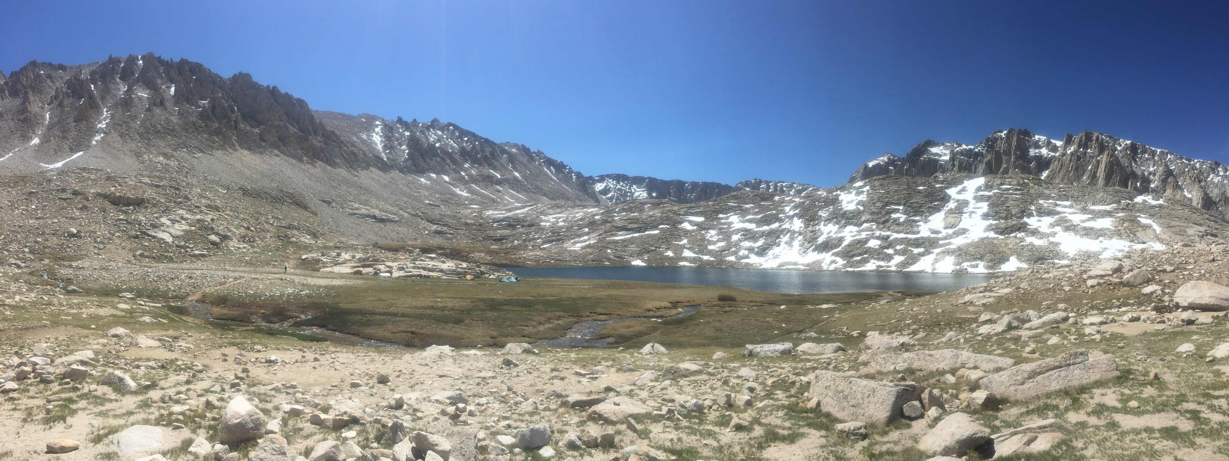
That’s why they called it Guitar Lake

Looking down at Whitney Portal

See the climbers going straight up the face in the crunchy snow?

Julian

I’m naming this lake “Hungry Hungry Hippo Lake”

Julian kayaking down some crunchy snow

And Keglegs doing the Penguin Slide

Coming back down to Guitar Lake and camp

A marmot too close to my tent.. (When I left Guitar Lake I left the body of my tent unzipped on purpose so if a curious marmot wanted to get in it wouldn’t chew through, just walk in the front door)
We put a little bit of weight back in our packs when we took down our tents and put our bear canisters back in. Then we headed back down to Crabtree Meadows where we stashed most of our food in the bear box. When we got to the junction, we drew straws with sticks to see who would run down the 0.2 mile spur trail to retrieve the food while the others waited with the packs. I was holding the sticks and of course got left with the short one!

Bear box at Crabtree Meadows

Julian said “mine is the green one with a small green caribeeener..” There were 3 other identical food bags!

Crabtree
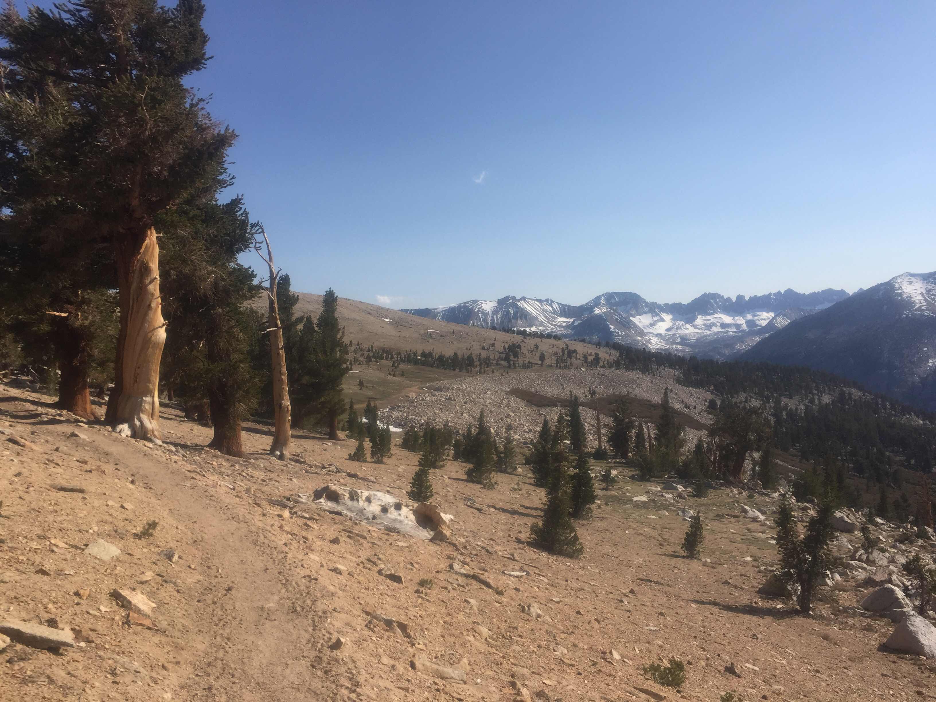
We met back up with the PCT and stayed the climb North towards Forrester Pass, the highest point on the PCT. It felt good to be back on trail, and although the Whitney detour was amazing and DEINITELY worth it, heading on towards Canada just felt right. The scenery going up was so amazing! After nearly 20 miles and over 12 hours of hiking, we climbed up into high meadows with huge granite boulders.

Jules doing his thang

It was just after I took this picture that I was talking to Julian and asked him, and we thought about how 99.99999% of people in the world will not see this specific place and view were standing in right now.. “How are we the ones that get to be able to see this right now?” I asked.
“We’ve worked hard to get here!” he answered.
I thought about that for a second. You know, we really did! We both got our permits months ago, personally I’ve hiked over 750 miles to get to this exact spot, (twice!). In general, the PCT has been one of the main things on my mind for nearly three years, ever since Claire and I decided we’d do it back in 2015! I’ve worked to save money for a whole year and a half with thruhiking this trail as my primary objective. I can say the same for Julian. We’re here, we’re doing it, we’re CRUSHING it!!
Whew, sorry for that little rant. Every corner I turned today was soooooo beautiful. I just kept snapping pics all day!


In the zone

Me and my always slipping sleeping pad..


I loved this high “meadow”


Crazy trees!
We finally got to Tyndall Creek, the first creek that usually has to be forded instead of rock-hopped over. Our little group has a rule that we can hike separately, but if we come to a pass, a sketchy ice/snow crossing, or an actual river or creek ford, we wait until we’re all together to proceed. Julian and I had been flying since Crabtree, but we only had to wait a couple minutes for Keglegs to catch up.
For a couple minutes after scanning the river, we thought we’d all just have to bite the bullet and get wet. But just before we did, I saw a small path through some bushes and found a (mostly) rock-hoppable Crossing which just required a large first leap. With these long legs I could jump it no problem and even stand across it. We made a train of about 6 hikers and I passed backpacks to and from each side. Then everyone put their packs back on after landing in the middle “island”, and were able to get across the small rocks mostly dry.
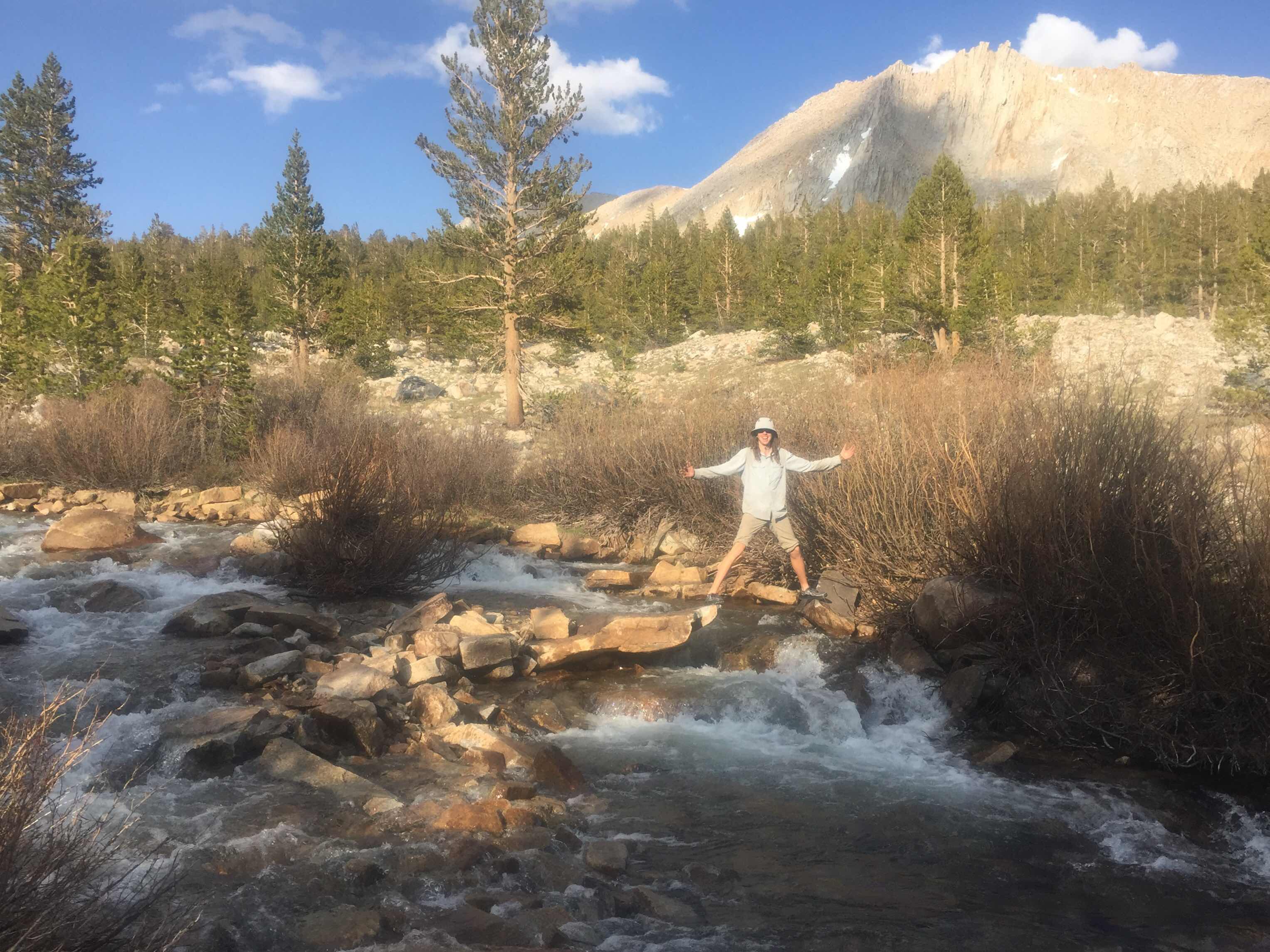
Doesn’t look sketchy from here but if a smaller person (like Keglegs or Julian), slipped on their landing with a full pack, it could be bad news!

Other hikers rock hopping after the main gap.
We finally rolled into camp after a very challenging 20+ mile day! I found a nice little spot tucked in between two trees and the others camped nearby. We were less than a 1/2 mile from the river crossing, and the raging river was the perfect distance away to have that nice, relaxing background noise to put you to sleep!

Finally resting!

My little site
Ok guys, super funny and random thing.. After setting up my tent, I had taken my bear canister over to where Julian and everyone else was eating dinner, about 30 yards along the trail up a hill. As Happy, Julian, Keglegs, and a few other hikers were eating and chatting, a marmot went right up to my tent. I yelled “Hey!” to hopefully scare it away. I’m not making this next part up... It jumped from that white rock you see to the left of my tent, into the rainfly at full speed/force, BOUNCED off the rainfly, then spun around and landed on its feet and ran away...
WHAT?!?! What did we all just witness? We laughed about it for a good 10 minutes, and I still can’t figure it out. Dang marmot!!
I’m actually writing this right now the next day. The moment I got into my on this night, I passed out so hard!! I had only slept a couple hours up at 11,000 feet, woken up at 1:30am, summited the highest peak in mainland America, then hiked up a HUGE climb, and crossed a river all in 20 miles and all by 6pm. I’m not even sure how many feet I climbed and ascended this day, but it was A LOT.. Now I’m about to write tomorrow’s blog, (or today’s), which I’m also super excited to share...
Thanks for reading!!
Loved this post!! What a day👍. Your pix are fabulous and I loved how you helped each other across the water. Very cool.
ReplyDeleteIs been one of my favorite days so far!
Delete